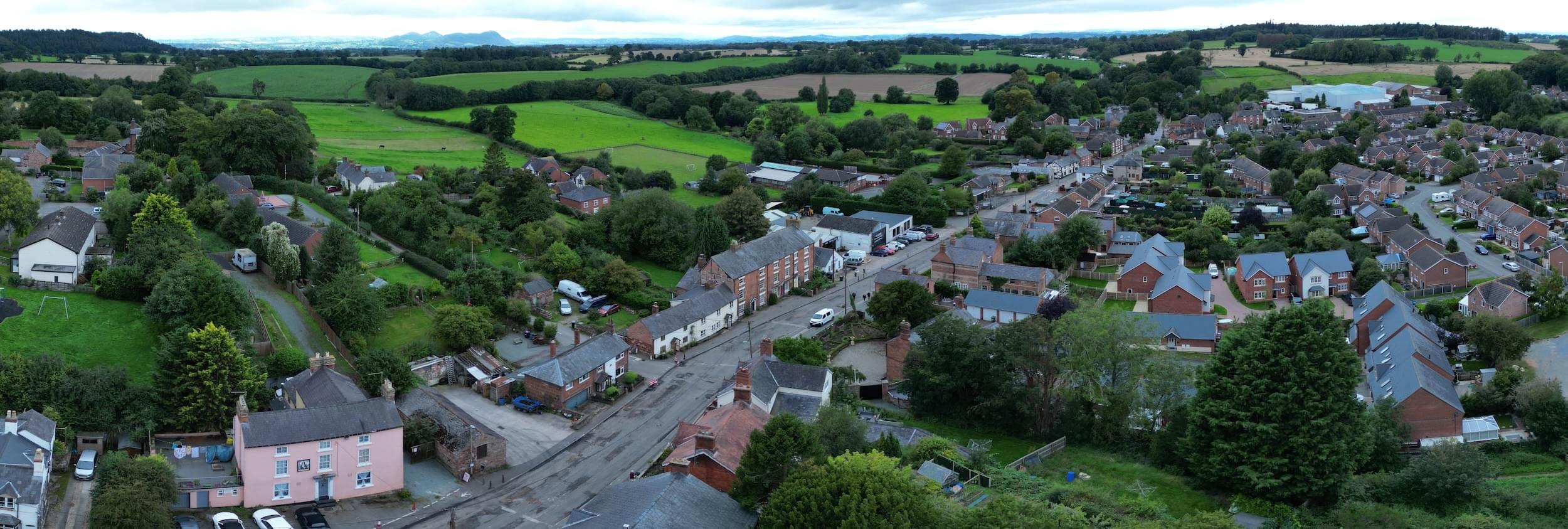
Click on the picture above to see the 360 degree panorama
The History of the Town
43AD to 410AD The sites of Iron age settlements can still be located in Ruyton today as well as two sites of Roman Villas.
655-675 AD It is believed that the area presently occupied by The Church, was the start of the original settlement of Angle Saxon times. A typical Anglo Saxon settlement would have consisted of wooden huts surrounded by a separate enclosure within an earthen bank and defended by a ditch. The present Pound Lane, Big Walls and Little Ness Road would have been the likely boundary . The first written record giving details of Ruyton appears within the Domesday Book
1080-1086 Ruyton being one of two Manors held by Odo who held Hordley for Earl Roger also held Udeford and Ruitone, Leofnoth held them as two Manors under Earl Roger. The area is described as being ‘waste land' but this is taken to mean that no rents were paid to the King. The owners all had Saxon Names but it is probable that it was occupied by the Welsh
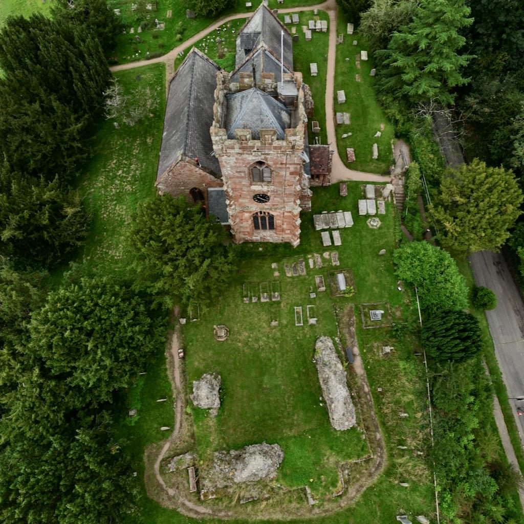
Above: The Parish Church of St John the Baptist and the remains of the Castle
1120-1148 The Parish Church of St John the Baptist was built. The ownership of Ruyton passed from Earl Roger to William FitzAlan and then to John le Strange. There is no definite date for the building of the Castle although it is listed as being in the reign of King Stephen before 1148.
1202 The Castle was said to have been destroyed by the Welsh and was never restored to its former strength, although it was said to have been rebuilt in some form in 1313 and is mentioned in 1357, as being maintained.
1308 The Earl of Arundel granted Ruyton its Charter, creating the Borough of New Ruyton. (Nova Ville de Ruyton), with another Charter in 1311 giving it the right to have its own Market .
1400 Owain Glyndwr burnt down the Town of Oswestry and then seems to have retained possession of all Powis-land for several years, which would have included Ruyton.
1533 The Reformation of the Church took place in the reign of Henry VIII with confiscation of much of the Church Plate and effects .
1536 Act of Union of England and Wales.
1540 Richard Kynaston presents Ruyton with its Mace.
1559 Elizabeth I sold all Church lands and houses in Ruyton ( inc the bells ) to Sir Thomas Hanmer.
1570 Reign of Elizabeth I, Silver Chalice made for Church.
1574 Thomas Kynaston building Ruyton Hall.
1579 The Cliffe is first mentioned (Clyve) {Walford Kynastons family name}.
1603 Reign of James I of England and VI of Scotland.
1637 New Church Bells are dedicated.
1645 Parliamentarians capture Shrewsbury.
1649 The Commonwealth. Oliver Cromwell.
1660 Reign of Charles II.
1702 Reign of Anne.
1700 Sees much of the land in the ownership of Lord Craven 6th Baron, it was divided and sold in 1777.
1714 Reign of George I.
1771 The Burlton to Llanymynech Road was cut through along the side of the present Church Yard and Gooseberry Lane.
1775 the agreement was drawn up for the draining of Baggymoor being passed in 1783. This included the straightening of the River Perry.
1788 The present Platt Bridge was started.
1791 Platt Bridge completed.
- 1801 Census shows 720 people in the Parish.
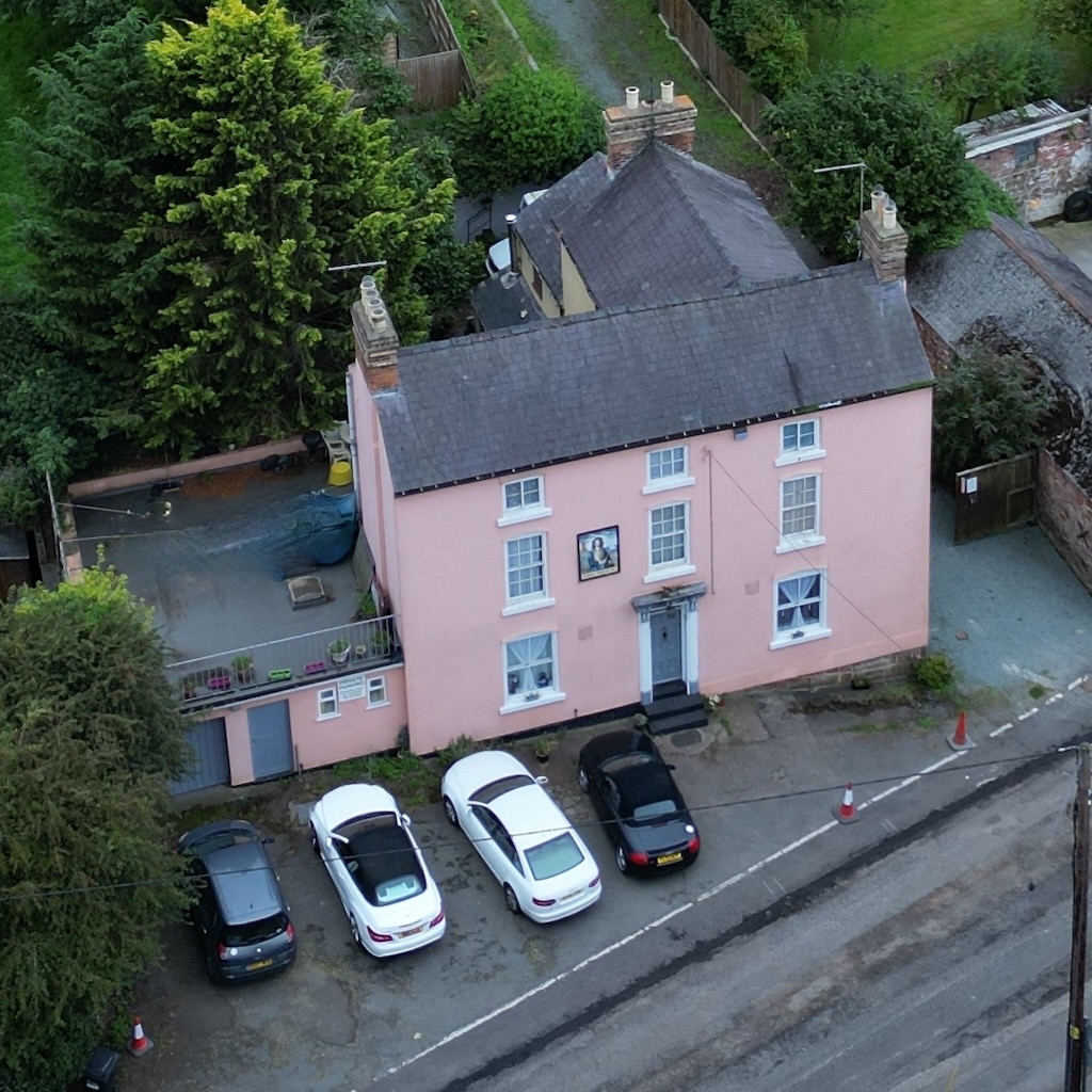
Above: The Admiral Benbow
1823 The Admiral Benbow is built
1824 The School was opened.
1832 United Reformed Church and Ministers House built in School Road.
1837 Reign of Victoria begins.
1838 Oddfellows estb. & meet at Admiral Benbow Lodge (769 ) ~ 277 members.
1841 The Toll House and Gate at Platt Bridge completed.
1845 Present Shop and Post Office established.
1860 Ruyton Manor/Towers built.
1860 Primative Methodist Chapel built in Brownhill.
1877 The Churchyard was enlarged with land being bought from Mr Minton, this included the remains of the Castle.
1881 The Cross was erected.
1883 A new Clock was installed in the Church Tower.
1902 The Victoria Reading Room was built.
1905 Edward Parry moved into The Talbot.
1914 The Oddfellows Hall (Present Parish Hall) built at the side of Castle View.
1918 Ruyton Co-Operative Dairy formed by William Howell Gittins of Hall Farm.
1918 Major C.M.Threlfall bought 'The Towers'.
1920 The War Memorial was constructed on the Brownhill Road.
1936 William Howell Gittins had the Memorial Hall Built.
1936 Dairy taken over by Kraft Foods.
1938 Electricity comes to Ruyton.
1940 Packwood School move into Park House, now Packwood Haugh.
1963 Mains Water.
1964 Express Foods takes over from Kraft.
1980's Pentons Haulage established.
1988 Dairi Pak started at Platt Mill Farm.
1989 Reliquary of St Thecla discovered.
1993 Express Foods Creamery closes.
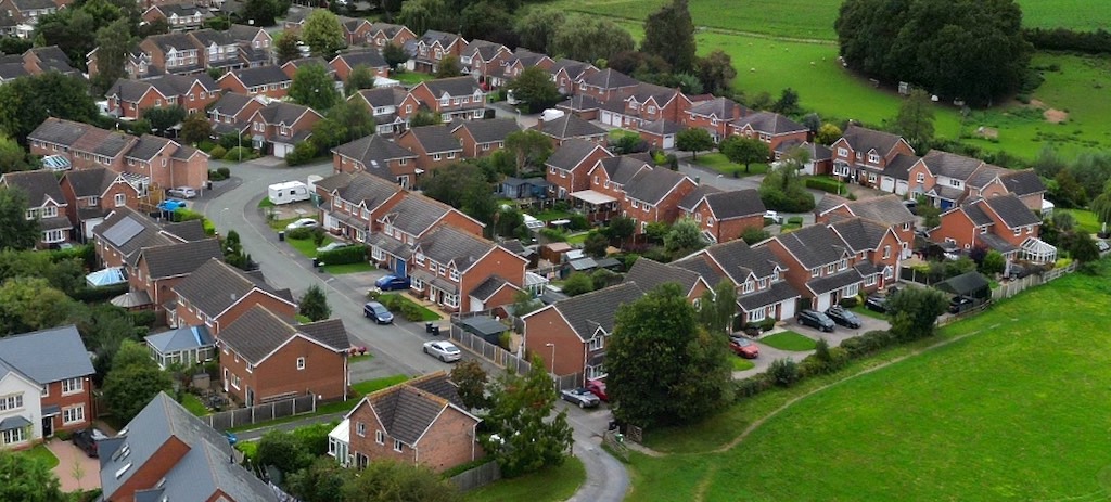
Above: Doctor's Meadow development
1994 Planning applied for the Dr's Meadow site.
2000-2001 Old School Closed.
2001 St John the Baptist, new Primary School opened.
2010 The Bridge Inn sold and became a private residence.
2011 in April Pre-School left the Village Hall to move into purpose built accommodation within the St. John the Baptist Primary School.
2018 Congregational Chapel and Manse sold for housing. Beacon lit on Brownhill to Commemorate the ending of WW1 .
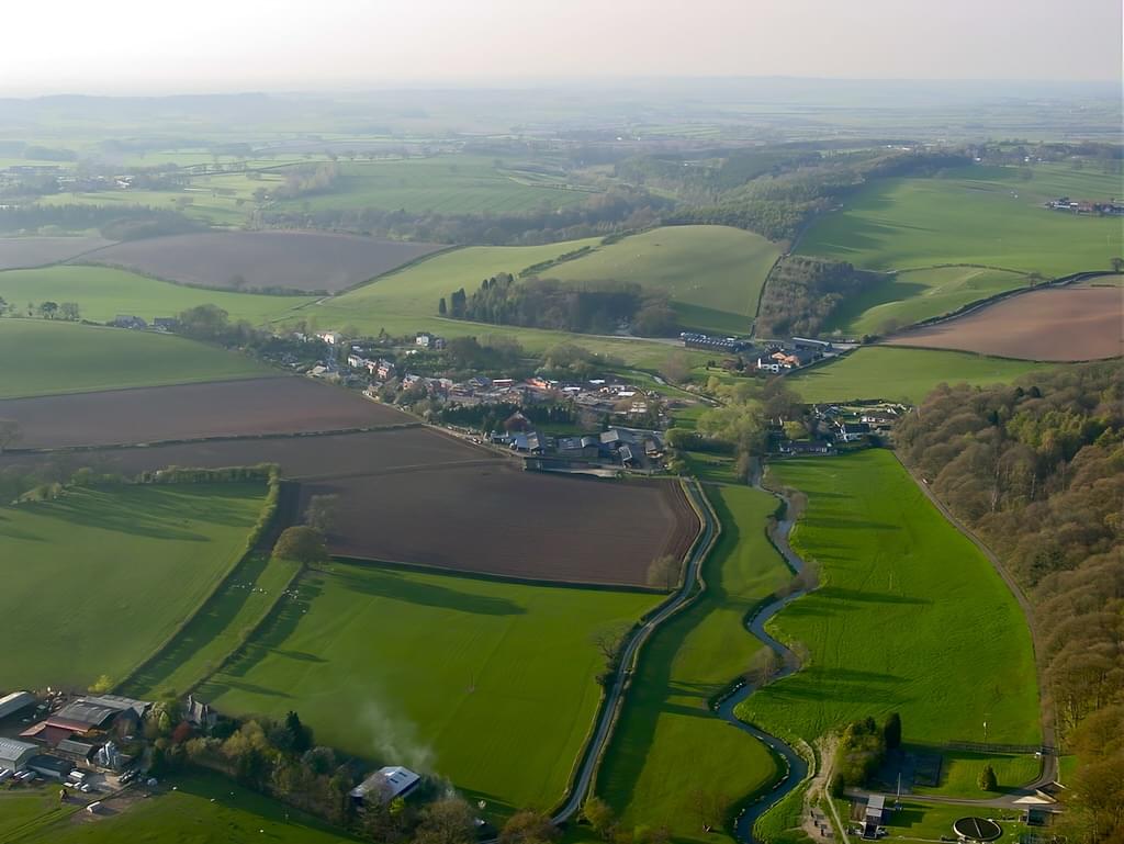
Above: The river Perry winding north towards Platt Bridge and Brownhill
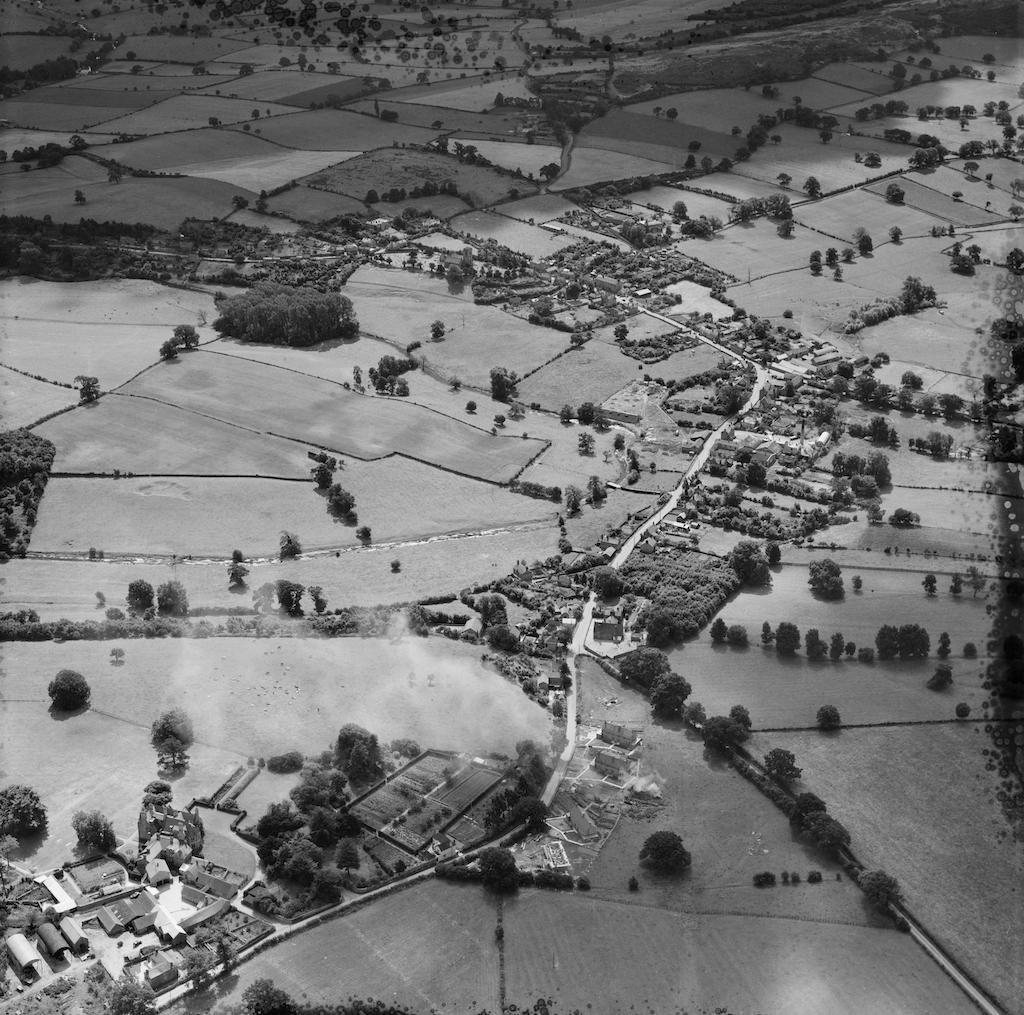
Ruyton XI Towns looking South East - 1951 © Historic England
Move the mouse pointer over the map to zoom in